HOMES FOR STROMNESSS
The Stromness Masterplan addresses the islands concerns regarding the prospect of incoherent or piecemeal development towards the south end of Stromness and to the West of the existing historic town centre and conservation area.
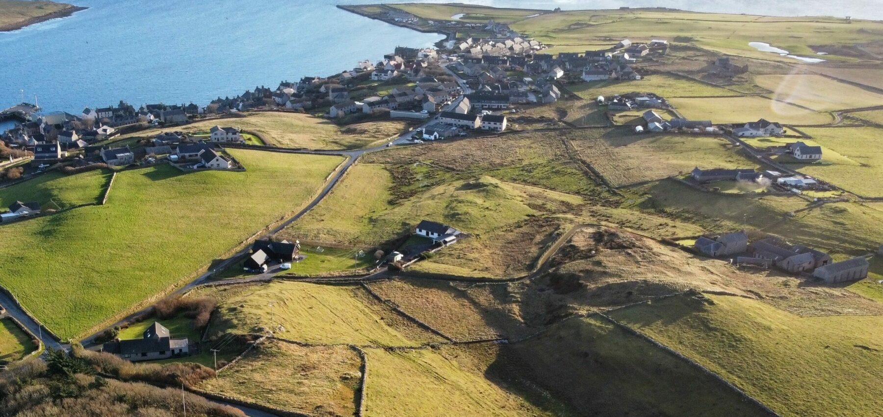
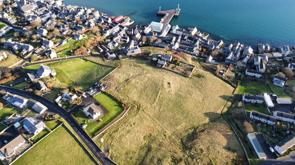
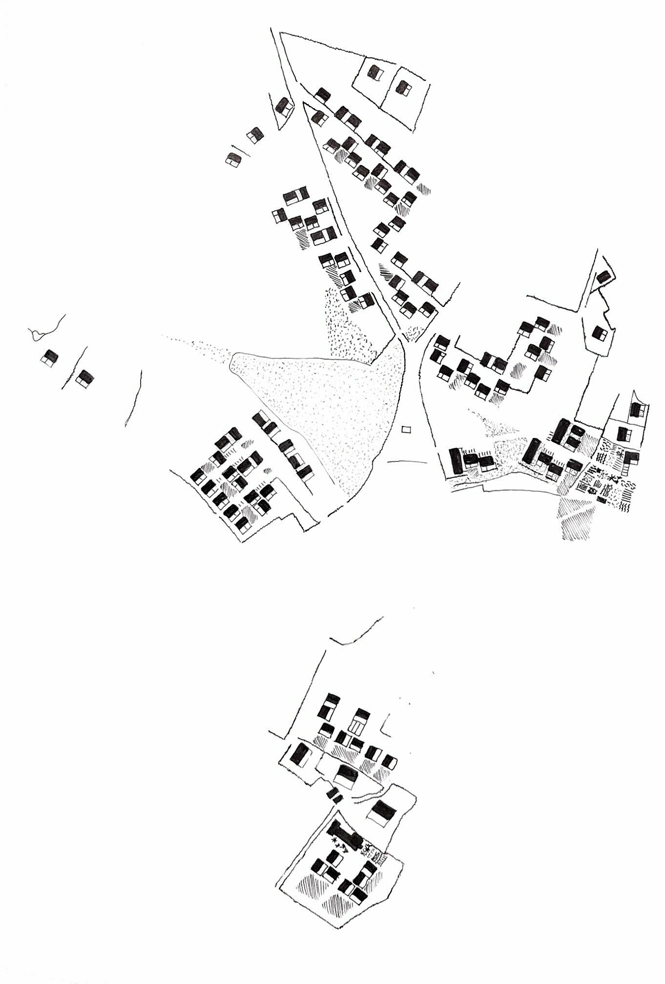
The six land allocations are complex with challenging topography, granite outcrops, areas of wetland and distinctive stone boundary walls which create the rich and unique character of the back of Stromness. The sites contribute to a high quality and distinct coastal landscape whose character could be easily eroded by insensitively conceived new development.
client: Orkney Islands Council
fla team: Ayla Riome, Andrew Dennison, Fredrik Frendin, Malcolm Fraser
landscape architect: Rankin Fraser
planning consultant: Aquatera
engineers: David Narro Associates
Sunshine and Views
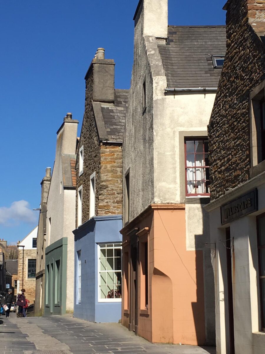
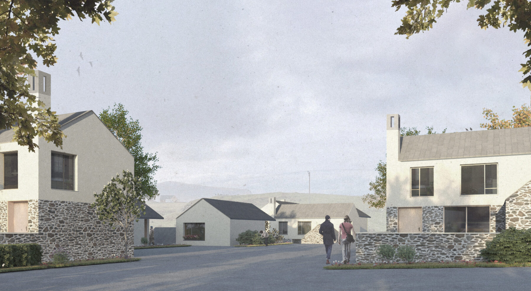
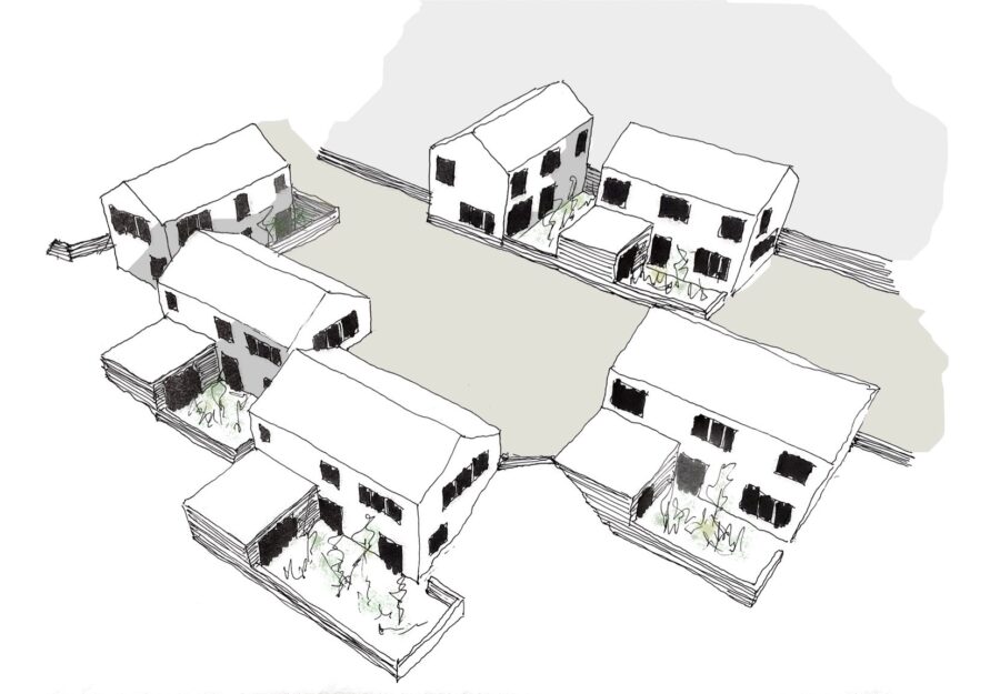
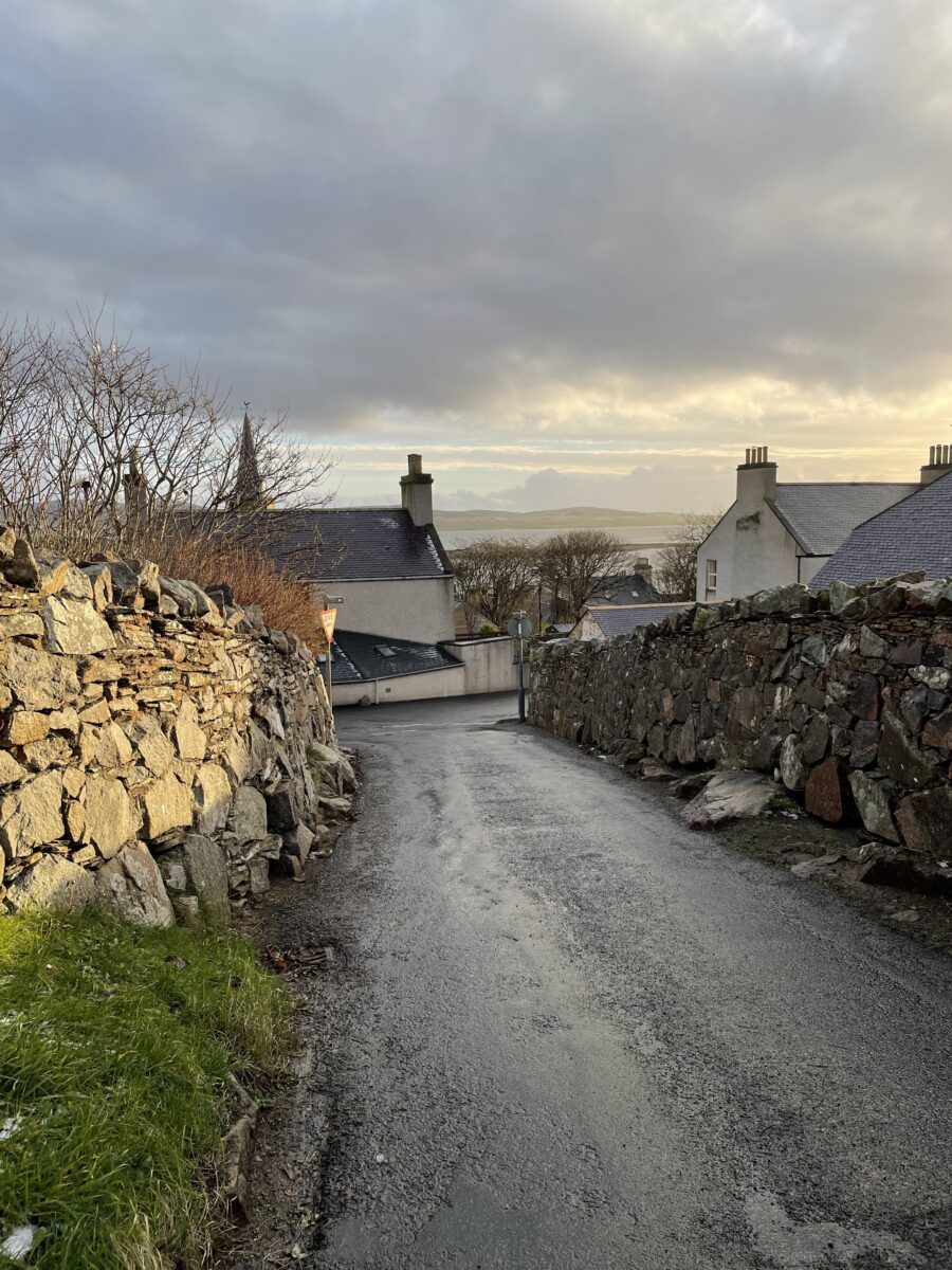
Stromness is characterised by the distinctive stone-built street line which hugs the coastline from the harbour and extends up the hilly landscape behind. This area is mostly south facing towards the sun and the views out, towards Hoy and across to Hamnavoe and the masterplan looks to take the opportunity to open up to the sunshine and views, placing living spaces and gardens towards them.
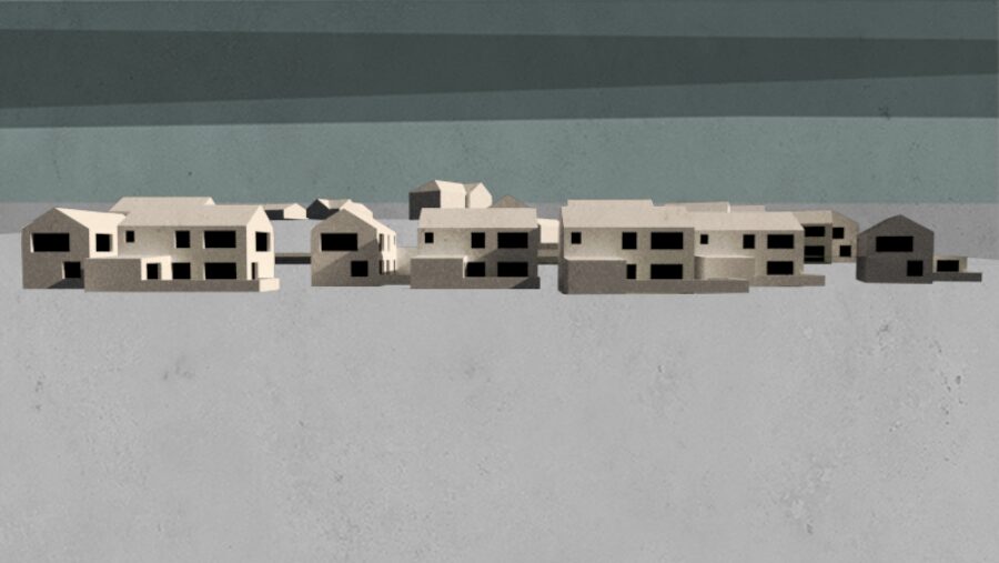
Buildings in Stromness tend to be positioned at right angles to each other step down to the shore and it’s the ambition that new houses reference this by working with the contours, stepping down the slopes. Given the complexities of the sites several areas are difficult to build on and with the ever-increasing housing demand on the island it was important to capitalise on the land available to ensure Stromness can expand despite the steeply sloping topography. As well as the views out from the proposals the views out from the existing houses and farmland are equally important to the inhabitants and a big draw to living in this area. Building down and into the slopes retains these views and allows houses to peak out over the top of each other.
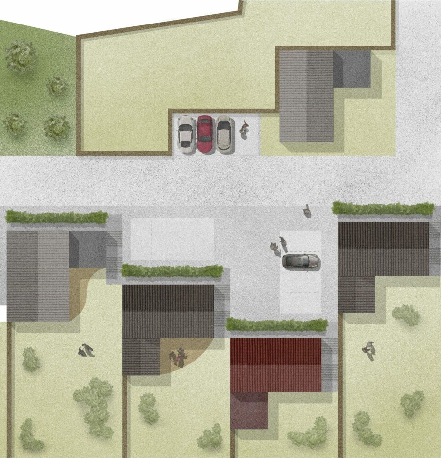
Shared Courts for Shelter and Neighbourliness
The town has developed in a traditional sheltered, herringbone pattern and is known for its narrow winding streets with occasional courts protected from the wind through built form. The proposal at the South End builds on and emphasises this by arranging homes round shared courts providing a small unit of community, for four or five sheltered homes. Building more densely brings the town closer and encourages active travel as well as leaving more open space, and existing forms to remain as enhanced green and blue infrastructural routes between the homes.

The Stromness Highway Code
The existing roads are narrow, winding and lined by drystone dykes. Maintaining these looks to promote and enhance the existing inferred code based around care and consideration for pedestrians and cyclists ensuring the rich characterful landscape of Stromness remains in place.
A life by the water
Stromness still heavily relies on its links to the sea for its livelihood placing an importance on a connection to the water. Beyond the water’s edge areas of fertile ground contrast with the uninhabited higher areas of moorland and hill with the Midgarth Mire settling between the two. The Mire, central to the land allocations, forms a clear route to the coast via the Mayburn and provides informal play spaces while also accommodating water run-off.